Roadtrips and going to at least 10 tourist destinations in Metro Manila are included in my Day Zero Project list. I, together with my boyfriend Alex, started the roadtrips last January 30. Where else it may be? No other than Philippine’s capital city: Manila!
Our itinerary: Intramuros and Rizal Park. As shameful as it may sound, I don’t have any memory of ever touring these places in my 29 years of existence. I may have gone off in one of our school fieldtrips before but I can’t remember, hence, I’ve decided that Manila should be first in our series of Metro Manila walkatours.
I did my homework prior to our tour, so here’s a little bit of history. Intramuros is the oldest district of Manila. It is a city inside a defensive wall built by the Spaniards in the late 16th century. The fortification protected the city from foreign invaders. It is also known as the Walled City, as “intramuros” is a Latin word which means “within the walls”. It was damaged during World War II, was restored and became a National Historical Monument in 1951.
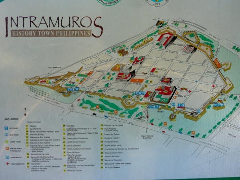
Map of Intramuros
We met at 7:00am and rode a Pier-bound jeepney from my office building at West Avenue. We got off at Plaza de Roma, which is the starting point of our walkatour. Plaza de Roma, also known as Plaza Roma, is one of two major public squares in Intramuros, Manila. The plaza is considered to be the center of Intramuros.
The plaza is a prototype of the Spanish colonial city planning. Like in most old towns in the Philippines, where the church, the municipal hall and houses of key officials surround an open court or plaza, Plaza de Roma is surrounded by what used to be major government buildings.
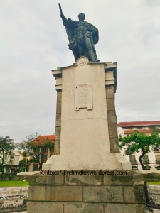
King Carlos VI Monument
Standing at the center of the plaza, cast in bronze, is the regal statue of King Carlos IV. The statue was locally made at Fort Santiago’s royal foundry or the maestranza. It was erected to honor the king for sending the first smallpox vaccine to the colony.
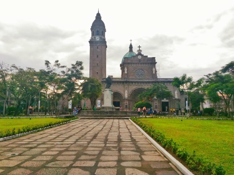
In front of Plaza de Roma is the Manila Cathedral. The Roman Catholic Basilica is the seat of the archbishop of the archdiocese of Manila and is located in the Intramuros district. It was originally built in 1581.
Plaza de Roma, Manila Cathedral at the background
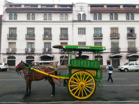
While taking pictures at the magnificent Manila Cathedral, we were approached by pedicab drivers and kalesa (horse-driven carriage) drivers who offered tours at PhP50 minimum to P300-500 per person. We refused all offers since we’ve decided to tour by foot. There are lots of vendors roaming around, selling various items like handmade accessories, rosaries, tourist maps, bottled water and pica-picas. We bought a pair of wooden bracelets and a pink beaded rosary for me.
A kalesa at Plaza de Roma
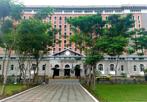
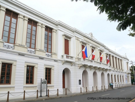
Other buildings surrounding Plaza de Roma are Palacio del Gobernador (now Commission on Elections) to the west, and the Casas Consistoriales, also known as the Ayuntamiento de Manila (now houses the Bureau of the Treasury) to the east.
Palacio del GobernadorAyuntamiento de Manila
Walking southeast from Plaza Roma passing via the left wing of the Palacio del Gobernador is Postigo Street. This street is named after the gate at the end of the road –Postigo de Palacio. This was the gate where Jose Rizal passed through from Fort Santiago on his way to his execution at Bagumbayan in 1896.
On the wall of Baluarte Plano Luneta de Sta. Isabel
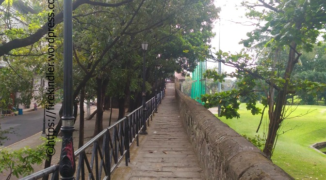
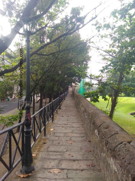
We climbed up the wall through the stairs beside the gate and walk down towards Baluarte Plano Luneta de Santa Isabel, passing by the San Ignacio Church ruins. We continued trailing the wall along Sta. Lucia St. until we reached Sta. Lucia Gardens.
Wall along Sta. Lucia StreetSta. Lucia Street
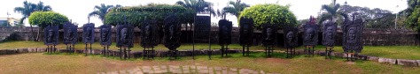
We then went down to Galeria de los Presidentes dela Republica Filipina, a site where murals of past Presidents are displayed.
Galeria de los Presidentes dela Republica Filipina
Strolling down Sta. Lucia St., we then turned right to Real St. At the corner of Sta. Lucia and Real is the ECJ Building, formerly the site of Casa Nueva, or the provincial house of the Agustinian Order. When it was destroyed by a fire in 1932, a two-story Adamson University was constructed; this eventually was destroyed in 1945.
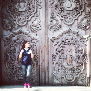
Farther down the street is the San Agustin Church & Museum – the oldest building in the Philippines and the last genuine heritage symbol of Intramuros. It was declared a UNESCO World Heritage Site in 1993. Note the missing bell tower, intricately carved doors, Chinese lions and amazing trompe o’l’oeil interior murals. We didn’t get to enter the museum though.
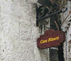
At the cobblestoned street of General Luna across the massive San Agustin Church is Plaza San Luis – named after one of the original four barrios of Intramuros. The plaza consists of Casa Blanca, Casa Urdaneta, Los Hidalgos, El Hogar Filipino, and Casa Manila. The replica houses where constructed based from archival building plans representing domestic architecture built during the Spanish regime.
Its ground floor houses shops while the second and third floor was conceptualized as a lifestyle museum showcasing colonial furniture amassed from different ancestral houses. Inside the mini villas are restaurants, a cafe, souvenir shops, a museum, a hotel and a venue for events.
Passing the arched portal of the plaza, we were transported back to the Spanish colonial times; rough whitewashed adobe walls line up the arcades, pathways are paved with flagstones, and intricate latticed capiz (mother of pearl) windows rounds up the upper walls of the courtyards. Deep wells, fountains and turrets are also featured along the maze-like passageways.
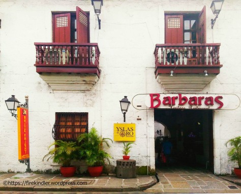
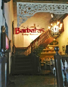
A fine dine restaurant now occupies the second floor – Barbara’s, where one can dine like a mestizo.
Aside from gift and specialty shops, the complex has a museum at Casa Manila – a Marcos reconstruction of a Spanish residence that showcases exquisite interiors . It contains late 19th century and early 20th century furniture found in a typical Filipino illustrado or the priviledged class home. Again, we weren’t able to enter the museum.
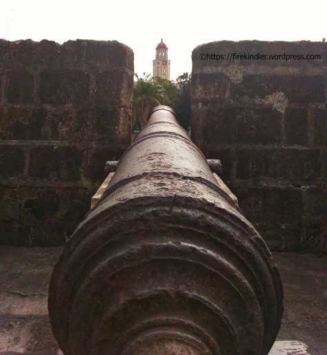
From Plaza San Luis, we passed by the residential areas until we reached Mapua Institute of Technology. We climbed up the wall again to Baluarte de San Francisco de Dilao where the canyons are located. Facing the Manila City Hall, it was built as defense against the Chinese population living near the walled city.
Baluarte de San Francisco de Dilao
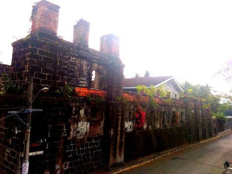
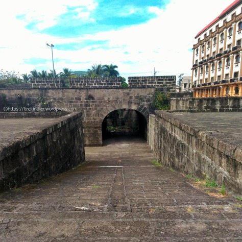
Our next stop is Baluarte de San Andres. Across Baluarte de San Andres is the former site of the mother house of the Augustinian Recollects known as the Yglesia y Convento de San Nicholas de Tolentino. The church was famous for its four-story bell tower of decreasing dimension and devotion to Nuestro Senor de la Pacencia. The site is now occupied by Manila Bulletin.
Baluarte de San Andres
And this is a dead end, there’s a “no entry” sign from this part of the wall to Baluarte de San Diego. There is a sign post which reads: “Watch Out For Flying Golf Balls.”
OLYMPUS DIGITAL CAMERA
It was almost 10:00 am and we haven’t eaten a decent breakfast yet except for a Dunkin’ Donut and brewed coffee so we decided to go down the wall and searched for the nearest place where we can eat. Avoiding fastfoods, we ended up at Dencio’s Diner and ate a hearty meal. We needed the nourishment for the second leg of our walkatour for the day: Rizal Park.
I will leave our Rizal Park adventure for my next post. 🙂